
Mobility data
·
Mobility data for places in Germany, Austria and Switzerland
Footfall, residents and visitors, transport mode and catchment flows for city centres and shopping streets. Delivered weekly as files or exports.
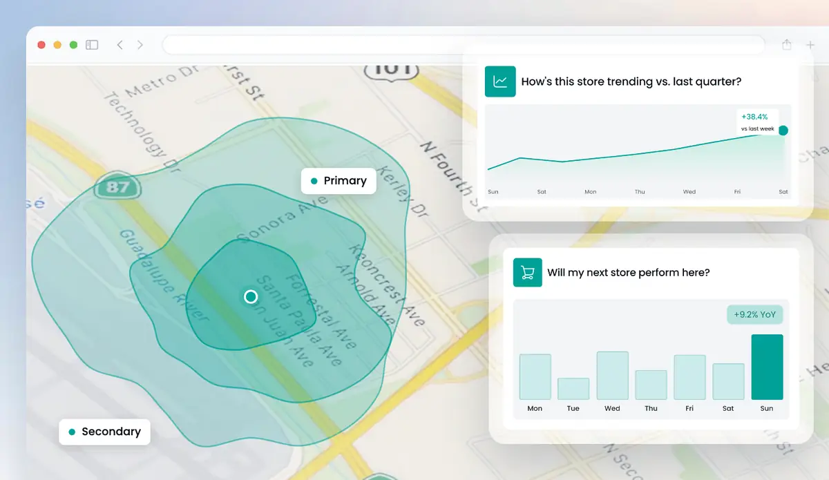
Get a free analysis of your locations
Up to 5 locations. No cost, no commitment.
Huq's mobility data shows how people move to and through places in Germany, Austria and Switzerland. For any city centre, shopping street or shopping centre you see footfall, residents versus visitors, transport mode, footfall density and where visitors travel from. It refreshes weekly. Analysts receive Parquet or CSV files in Amazon S3 or Google Cloud Storage. Planners and leasing teams use the map and Excel exports.
Where to find mobility data in Huq
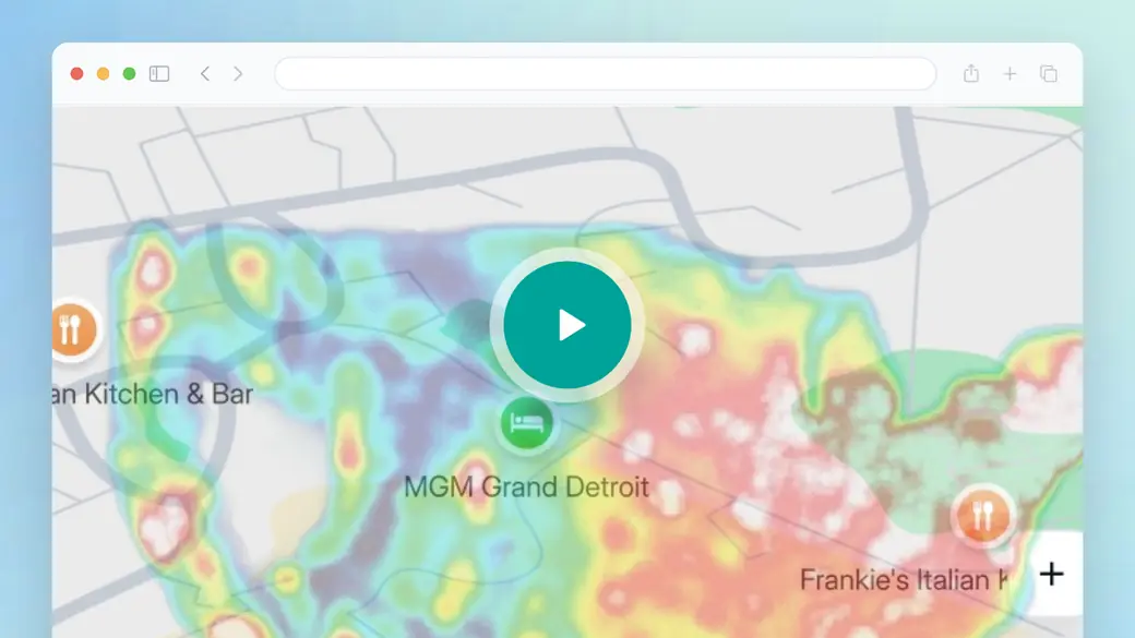
Look for the Explore map in the overview. Its heat maps show visiting and passing traffic. Its catchment and travel-time layers show where people come from. Those are Huq's movement views for a DACH city centre. The data behind them can be exported or delivered to your bucket every week.
- Heat maps of visiting and passing traffic in a city centre.
- Catchment and travel-time layers in km.
- Export options that match the weekly data feed.
Trusted by 300+ organisations · Data across 35 markets






What is mobility data, and what is it not?
In Germany, mobility data often means transport data: timetables, traffic flows and public data spaces for the transport sector. Huq does not supply that kind of data.
Huq's mobility data, also called movement data, is about places. It answers the questions retailers, landlords and cities ask. How many people come to this shopping street? Do they live nearby or travel in? How do they arrive? How busy is each part of the city centre? Where does the catchment end? Did a city centre programme bring more visitors than in similar cities?
Accuracy is published by country. Germany is Huq's best market, with a MAPE of 13.5% against landlord-reported footfall. Huq also has 800+ validated target areas across Europe. Data refreshes weekly, so changes after an event, a store opening or road works show up in the next refresh.
What's in your DACH mobility data
01
Footfall and passing traffic
Weekly, monthly and yearly footfall, with visiting versus passing traffic.
02
Residents and visitors
The share of local residents and people travelling in, including international visitors for tourism.
03
Transport mode and density
How people arrive, and how footfall density changes across a city centre.
04
Catchment flows
Visitor origin by postcode, with drive-time and travel-time areas in km.
What DACH mobility data shows
Three views for planning, leasing and reporting.
01
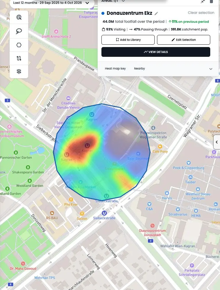
Density on a shopping street
A heat map of visiting and passing traffic. See which end of the street draws people.
02
Residents versus visitors
Weekly share of residents and visitors for a city centre or shopping centre.
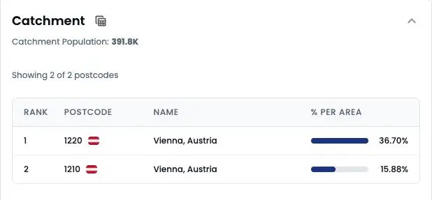
03
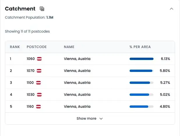
Where visitors travel from
Postcodes ranked by visitor numbers, with travel-time bands in km.
Mobility data across DACH
How it works
Step 1
Tell us your locations
Add up to five addresses in the form. Your own stores, candidate sites or competitors.
Step 2
We run the analysis
Our team maps each location from observed visitor data.
Step 3
We walk you through it
A short call to take you through what the data shows and what it means for you.
Why teams use Huq for movement data
Who it's for
01
02
03
About Huq
Huq is a location intelligence company. We turn anonymised mobile location data into footfall, catchment and visitor insight for any place, so retailers, property owners and local authorities can make decisions on evidence.
See how your locations really perform
Up to 5 locations. No cost, no commitment.