
Catchment area analysis
·
United States
Catchment area analysis for your US stores and sites
See where each location's visitors actually come from, split into primary and secondary zones. Start with a free catchment report for one US site.
Get a free analysis of your locations
Up to 5 locations. No cost, no commitment.
We handle your details in line with the CCPA and applicable US state privacy laws.
Catchment area analysis shows the area a store or site draws its visitors from. Huq maps it from where visitors actually come from, for any US address including competitor locations, and lets you compare it with drive time. See visit share by ZIP code, residents vs visitors and where catchments overlap. US teams often call this a trade area. More than 1,000 locations are manually validated in each of Huq's 35 markets twice a year.
See how catchment area analysis works in Huq
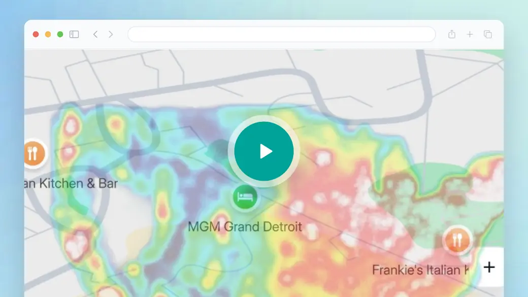
This overview tours the Huq platform. For catchment area analysis, watch how the Explore map's catchment and travel time layers work, and how heat maps split visiting from passing traffic. You'll also see how a location's catchment appears in exports and monthly PDF reports, which is how most teams share it with colleagues.
- Catchment: visit share by ZIP code and catchment population, so you can see where a location's visitors live.
- Drive-time analysis: compare the observed catchment with how far people can travel in a set time.
- Cross-visitation: shared visitors between locations, to spot overlapping catchments.
Trusted by 300+ organisations · Data across 35 markets






What is catchment area analysis?
Catchment area analysis defines the geographic area a location draws its customers or visitors from, and measures what's inside it. In US retail and commercial real estate, the same idea usually goes by the name trade area. Catchment analysis is also used for schools, hospitals and watersheds; this page is about retail and commercial locations.
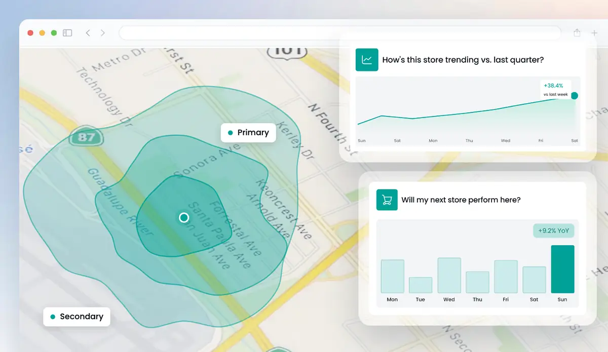
Catchments are usually split into zones. The primary catchment is closest and supplies most visitors, the secondary sits further out, and the tertiary covers occasional visitors from further afield. Traditional methods draw these as distance rings or travel-time zones (isochrones), which model where visitors should come from.
Huq shows the observed catchment, by ZIP code, alongside drive-time analysis and residents vs visitors. That's the difference between a tidy shape on a map and the real pull of a site.
What's in your catchment area analysis
01
Visitor origin heatmap
A map showing where each location's visitors actually come from, for your sites and competitor sites alike.
02
Zones by ZIP code
The catchment split into primary and secondary zones by share of visits, with catchment population.
03
Catchment overlap
Shared and unique visitors across up to 10 location pairs, to spot cannibalization between your sites.
04
Residents vs visitors
Who lives around each location and who travels into it, compared with nearby competitors.
What a catchment area analysis shows
The free catchment report covers one location. These are the three views it includes.
01
Visitor origin heatmap
Where this location's visitors come from, shaded by share of visits. Hotspots outside the expected area often follow commuter routes or a nearby attraction.
02
Observed catchment vs a drive-time zone
The observed catchment laid over a 15-minute drive-time zone. Where they differ, the model is missing a barrier, a competitor or a reason to travel further.
03
Catchment overlap with nearby sites
Shared visitors between this location and nearby sites. High overlap with your own sites suggests cannibalization; low overlap means each site serves its own area.
Catchment area analysis across the US
Huq covers any address in the United States: shopping centers, main streets, downtowns, strip malls, competitors' stores and sites you haven't opened yet. No counters, sensors or cameras needed.
Huq manually validates more than 1,000 locations in each of its 35 markets twice a year, and data refreshes weekly.
How it works
Step 1
Tell us your locations
Add up to five addresses in the form. Your own stores, candidate sites or competitors.
Step 2
We run the analysis
Our team maps each location from observed visitor data.
Step 3
We walk you through it
A short call to take you through what the data shows and what it means for you.
Why retail and property teams use Huq for catchment analysis
- Huq publishes its accuracy by country: a 19.5% median error across published markets, against a 30% healthy threshold.
- Huq's customers give it an NPS of 42.
- Trusted by 300+ organizations across 35 markets, including the global insights, research and location intelligence teams at Nike, Adidas, JD Sports and Samsung.
huq's platform gave us valuable data to support a key decision on potential new sites.
Dan Brogden
National Sales Manager, Puccinos
Who it's for
01
Retail chains of any size
From five-store retailers planning their next site to national brands: choose locations, track store performance and benchmark against competitors.
02
Retail real estate owners
Show shopping center performance, support leasing and get the tenant mix right, for landlords, asset managers and brokers.
03
Investors and private equity
Check how retail brands and assets actually perform before you buy, and monitor them after.
Everything Huq measures, in one platform
- Foot traffic: by week, month and year, with totals, average daily foot traffic, trends, period-over-period change, and visiting vs passing traffic.
- Residents and visitors.
- Trade area and travel time: trade areas by ZIP code, plus drive-time and travel-time analysis.
- Demographics and profiling: age, gender and purchasing power, available in selected markets.
- Behavior: visit frequency, dwell time, time of day and dayparts, cross-visitation between up to 10 location pairs, and international visitation for tourism.
- Foot traffic density and transportation mode.
- Places, brands and industries: points of interest, brand locations and brand analysis, industry performance, shopping center and retail center types.
- Geo-spend: spend by volume and category, available in selected markets.
- Tools: the Explore map (draw any area or use layers for travel time, trade areas, shopping centers, retail centers, brand locations, industries and ZIP codes), White Space Analysis, and Projects for monitoring many locations and reporting to stakeholders.
- Delivery: the platform, CSV or Excel exports, monthly PDF location reports, and data feeds as Parquet and CSV files into Amazon S3 or Google Cloud Storage buckets.
- Cadence: data refreshes weekly.
Frequently asked questions
What is a catchment area?
A catchment area is the geographic area a location draws its customers or visitors from. In US retail and commercial real estate it's usually called a trade area. It's often split into a primary zone that supplies most visitors, a secondary zone further out and a tertiary fringe. Huq maps it from where visitors actually come from.
How do you determine a catchment area?
There are three common approaches. Distance rings draw a radius around the site. Travel-time zones, or isochrones, show how far people can get by car or on foot in a set time. Observed catchments use where visitors actually come from. Huq offers the observed catchment and drive-time analysis side by side.
How do overlapping catchments affect cannibalization?
When two of your sites draw from the same area, a new store can take visitors from an existing one instead of adding new ones. Huq's cross-visitation shows shared and unique visitors across up to 10 location pairs. JD Sports, a UK retailer, used Huq's catchment insights and saw 25% more precise catchment analysis.
What's in the free catchment report?
We'll analyze one of your US locations: a heatmap of where its visitors come from, its primary and secondary catchment zones, and a comparison with a drive-time zone and nearby sites. There's no commitment, and no hardware or site access is needed.
How often is catchment data updated?
Weekly. Catchments shift with the seasons, new competitors and changes to roads and housing. Weekly data lets you follow those shifts week by week, instead of relying on a one-off study that may be out of date by the time you act on it.
Which US locations can Huq analyze?
Any address across the US, including stores, restaurants, shopping centers, main streets and competitor locations. Huq needs no sensors, cameras or hardware, and validates more than 1,000 locations by hand in each of its 35 markets twice a year. It isn't built for school, hospital or watershed catchments.
Questions? Talk to us
Book a demoAbout Huq
Huq is a location intelligence company. We turn anonymised mobile location data into footfall, catchment and visitor insight for any place, so retailers, property owners and local authorities can make decisions on evidence.
See how your locations really perform
Up to 5 locations. No cost, no commitment.